Gasr Zemmour

. Posted in Mountain Gsour

GPS Coordinates: N33°16.081’E10°11.953’

Governorate: n.d.

Delegation: n.d.
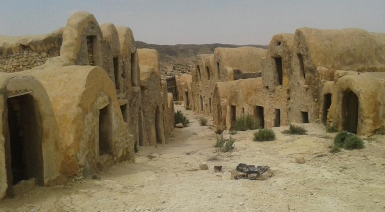
Gasr Zemmour - Photos : M.lle BouchraPhotos: Miss Bouchra

How to get to the Gasr: Located on the road from B.K towards El Medhar, in the direction of Jebel Mzenzen.

Suitability for tourism: yes

Surrounding Facilities: The Gsour is located on an elevation (altitude 624m) and has an elongated shape of about 200 m.

Location relative to urban center (Km): n.d.

Construction Date : 19th century
Number of Ghorfas : several ghorfas
Number of floors : one single floor with some exceptions of two floors
Number of external doors : wooden doors

Facilities in the Gasr: n.d.

Architectural Condition: The western part is in good condition with wooden doors, but the eastern part is in ruins. The Ksar was restored in 2006 (23 ghorfas) and 2009 (32 ghorfas).


NOTICE

 Site visitors are advised that data entry for the GMG project is still in progress, so some pages may still be incomplete. We apologize for the inconvenience. 

PROJECT PARTENAIRES

  • Autonomous Region of Sardegna
    Autonomous Region of Sardinia (Italy)
    Project Funding Organization
  • ASECON Association Amici Senza Confini
    ASECON (Italy)
    Association "Friends Without Borders"
  • ONM National Mining Office
    ONM (Tunisia)
    National Mining Office
  • CNR National Research Council
    CNR (Italy)
    National Research Council
  • PGSA-SAR Historical and Environmental Geomineral Park of Sardinia
    PGSA SAR. (Italy)
    Historical and Environmental Geomineral Park of Sardinia
  • Municipality of Masullas
    Municipality of Masullas (Italy)
    Province of Oristano
    Region of Sardinia
  • Municipality of Gadoni
    Municipality of Gadoni (Italy)
    Province of Nuoro
    Region of Sardinia
  • Friends of Sardinia ONLUS
    Municipality of Gadoni (Italy)
    Province of Nuoro
    Region of Sardinia